It’s old news that Earth is on fire. How long till we’re cooked?
By climate scientist estimates, 25 years. I chuckled when a colleague told me she had since accepted our fate. For the last 175 years, we’ve relied heavily on our liquid ancestors to support our lifestyle and we’re now soaking in ocean-deep debt.
But what if we could do something about it? What if you could?
And I don’t mean the sacrifice of today’s simple pleasures for a better tomorrow. I mean something real. Value we can actually bank on to truly fix this mess.
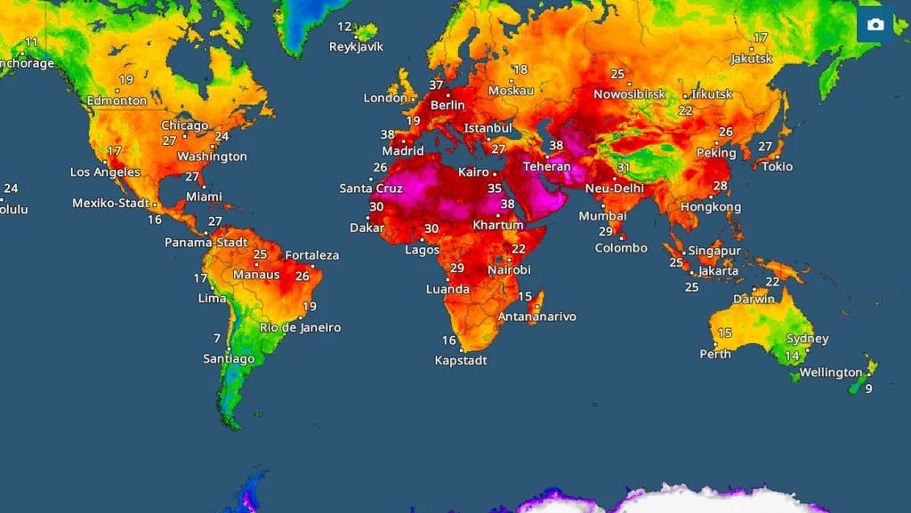
If you still don’t believe in climate change, check out the flooding in Nigeria for the past few years. I hear it’s happening in Congo as well. What Africans don’t get is that Africa burns first.
Or floods first, whichever you like.
Earth is on fire, and Africa burns first.
Africa contributes only 4% of global carbon emissions. And we don’t have the infrastructure for such a catastrophe as climate change. If anyone should be investing heavily in solutions and countermeasures, it should be us.
So I’m writing this not to scare you, but to bring you tangible hope that I’ve held with my own hands.

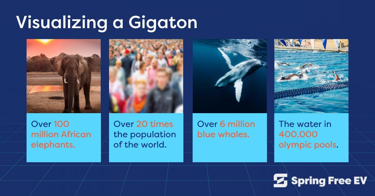
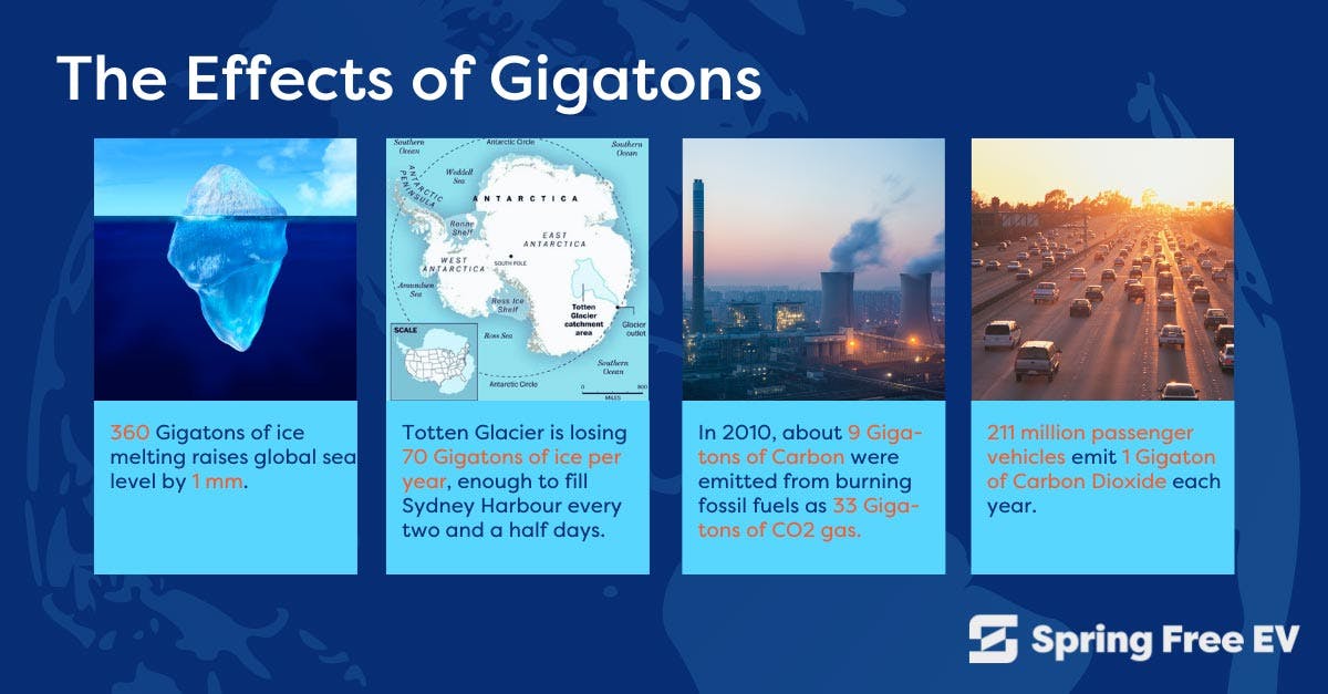
Gigatonnes in Carbon Debt
What sacrifice do we offer to appease the carbon god?
Today, we’re ~286 GtC (gigatonnes, or billion tonnes, or trillion kilograms of Carbon) in debt. And this mess is exploding yearly.
If there’s any chance of us saving ourselves on time, it’ll be built on space technology. What a time to be alive.
Who would’ve thought that most promising earth application of space technology would be to help us restabilise our planet’s surface temperature?
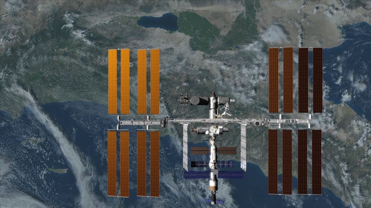
Satellites give us a planetary-scale foothold in the void of space.
This means we can see if our efforts are actually working, predict disasters & respond early, and provide crucial information during environmental disasters.
We will build our future on them in these critical 25 years.
But currently, there is no planetary-scale climate action being taken.
How do we know for sure that our climate is changing?
Assuming we want to ignore all the melting ice in the Arctic and the terrible droughts & flooding in Africa, we would need to collect data, right? As all good scientists should.
We have some options.
We could measure the amount of CO2 in the air. And we’ve been doing that. But how do we know it’s this tiny 0.02% increase that’s cooking us all?
Carbon dioxide is a natural heat trap. So we can see how an excess can increase the heat. But by that much? Enough to melt the ice caps?


Wanna fuck around until your whole city is flooded to find out?
The problem with climate action is that people are not used to thinking at a gigatonne scale, so they can’t compute chaos theory, or how small actions result in unpredictable outcomes. Instead, we are most concerned with our own small point of view in the grand scheme of things.

That’s why we would be blind enough to ignore all the melting ice in the Arctic and the terrible droughts & flooding in Africa. or the disease caused by harmful ultraviolet rays the Earth could not protect us from. The planet could not protect us from ourselves.
How did we get the information that the ice was melting? Satellite images. And the shrinking of Lake Chad in Africa? Satellite images. And the UV index for the day? Yes. Satellites.
What’s a satellite again? A smaller mass orbiting a larger mass in space. 🛰
Any effective climate action will depend on such space technology to help us match & manage the scale required to solve this problem:
If our yearly emissions increase our GtC debt much faster than our remedial actions, then this is a game of speed played through scale.
A Game of Speed
What happens when your cells become aware of you?
Once we realised how small we were in the celestial scheme we began to see as a celestial might.
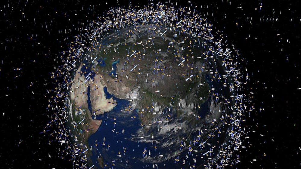
With our foothold secure, we sent out space tools. Satellite-based radiometers, gravimeters, spectrometers, LiDAR, and many other special cameras & sensors expanded our understanding of our situation.
We sent out many more satellites, tracking planetary albedo, gravitational field strength, ocean temperature, polar ice thickness, carbon dioxide concentration, deforestation, UV radiation and air quality.

We began to comprehend the Gt-scale effect we’re making on this planet yearly, being able to zoom out and understand how microsystems move macrosystems and the level of work we have to do to rebalance the equation.
Everyone who knows their onions knows this: if we can reach the required scale of remedial action on time, 25 years is feasible.
While this sounds easy, human nature itself is what got us here. So we have to bet on it if we want to make high-level changes effectively. If we absolutely must win the versus against climate change, we must make 3 bets:
we can’t change human nature on time.
With only 25 years left to take action, we can’t be making flimsy bets. Any changes we need to be making must be viewed from the scales of production, distribution and emission.
So fuck the tree-planting, artwork and carbon neutrality. How can we really solve this problem?
If you don’t know the answer, here is mine.
we can make profits from climate action.
Save your protests for Greta Thunberg & friends. All organisms must produce valuable waste for this planet to run, even you.
Fuck feeling like you can’t do something real about the climate problem. We build the bioeconomy instead from the excess carbon. Environmental Biotechnology.
Climate action costs resources. If we make it profitable at the Gt scale, we can take planetary-scale action with all the liquidity investors like you bring.
At Solarium, we’re building Earth’s first truly profitable carbon token to help you fund climate action (yay us) and make profits from it (yay you). How?
we can measure the outcomes.
In the carbon token’s webpage and in Near-Zero (my award-winning stablecoin article on Hackernoon), I discuss our total reliance on oracles to feed climate data into our token’s smart contracts. Oracles are the spirits of our ancestors whispering sweet nothings into a block–I mean, a third-party service that provides external data to a blockchain.
Their data will come directly from the network of satellites and space stations orbiting Earth, and managed by the organisations in charge of them that we will collaborate with.
With all this satellite data publicly available, reaching Solarium’s 25-year mission becomes more than the internet screams of a mad man. Space technology means we’ll know if our planetary-scale climate action is working by using these metrics:
Planetary Albedo
Question: How much sunlight is Earth reflecting?
Purpose: The heat trapped by excess atmospheric carbon will absorb more light. More light? More heat. And the beat goes on.
Tools: Satellite radiometers like MODIS (on NASA’s Terra and Aqua satellites), VIIRS (on NOAA’s Suomi NPP and JPSS satellites), and CERES (on NASA’s Terra, Aqua, and NOAA-20 satellites) which measure the shortwave solar radiation reflected by the Earth.
Coverage: Global (CERES), Near-Global (MODIS & VIIRS)
Data Access: Publicly available on NASA’s Earthdata portal
Data Management: Split between NASA DAACs (Distributed Active Archive Centres) for Land Processes (LP) & Atmospheric Science Data Center (ASDC)
Gravitational Field Strength
Question: Is Earth’s gravity field changing?
Purpose: If the mass of a planet moves around, its gravity will change too. If it’s not moving to my latest album, what’s it moving? Yep. All that melting ice from an overheating planet.
Tools: Twin-satellite gravimeters like GRACE (Gravity Recovery and Climate Experiment**)** and GRACE-FO (GRACE-Follow On), using their relative distances to measure gravity fluctuations.
Coverage: Global
Data Access: Publicly available on NASA’s Earthdata portal (free login).
Data Management: NASA’s Jet Propulsion Laboratory (JPL) DAAC and the University of Texas at Austin’s Center for Space Research (UT-CSR).
Ocean Temperature
Question: How much heat are the oceans absorbing?
Purpose: We definitely don’t want to cook all the fish on Earth at once. Or do we?
Tools: Satellite radiometers like VIIRS (on NOAA’s Suomi NPP and JPSS satellites), SLSTR (on ESA’s Sentinel-3 satellites), and AMSR2 (on JAXA’s GCOM-W1 satellite) measure the thermal infrared energy or microwave radiation from the ocean.
Coverage: Global ocean surface temperature
Data Access: Publicly available on NASA’s Earthdata portal. Also available from NOAA CoastWatch.
Data Management: NASA’s Physical Oceanography (PO) DAAC, and NOAA’s CoastWatch.
Polar Ice Thickness
Question: How much ice do we have left?
Purpose: More heat means less ice. Less ice means more water. More water means more heat. What a time to be alive.
Tools: Satellite altimeters like ICESat-2 (NASA, lasers) and CryoSat-2 (ESA, radar) measure the height of ice we have left from space.
Coverage: Polar regions
Data Access: Publicly available on NASA’s Earthdata portal
Data Management: National Snow and Ice Data Center (NSIDC DAAC)
Carbon Dioxide Concentration
Question: What percentage of air is CO2?
Purpose: CO2 is the chief warden of all the sun’s heat energy trying to escape Earth through air. You’ll never escape, he says. But solarium will make him an offer he can’t refuse.
Tools: Dedicated missions like OCO-2 (Orbiting Carbon Observatory-2) and OCO-3 (Orbiting Carbon Observatory-3) (both NASA).
Coverage: Near-Global (OCO-2), Latitudes ~52° N to 52° S (OCO-3) from the International Space Station (ISS), excellent for monitoring the equator
Data Access: Publicly available on NASA’s Earthdata portal
Data Management: NASA’s Goddard Earth Sciences Data and Information Services Center (GES DISC)
Deforestation
Question: Do we have enough trees left to fight the heat?
Purpose: Imagine a world without shade. As if that’s not enough, they convert the excess carbon in air into an energy source that feeds, fuels & protects the world.
Tools: High-resolution optical imaging satellites like LANDSAT-9 (NASA/USGS), Sentinel-2 (ESA/Copernicus), and others from commercial providers take photos to help us compare how much land is covered in beautiful green trees.
Coverage: Near-global land surface
Data Access:
Data Management: USGS Earth Resources Observation and Science (EROS) Center (LANDSAT-9) and the European Space Agency (ESA) for Sentinel-2 data within the Copernicus program.
UV Radiation
Question: How much surface protection does Earth have left?
Purpose: Too much UV radiation will kill every living thing, slowly or quickly, depending on the amount we’re dealing with.
Tools: Satellite spectrometers like OMI (Ozone Monitoring Instrument) on NASA’s Aura satellite, and GOME-2 (Global Ozone Monitoring Experiment-2) on ESA/EUMETSAT’s MetOp satellites measure the strength of UV energy reflected to the satellite.
Coverage: Global.
Data Access: Publicly available on NASA’s Earthdata portal
Data Management: NASA’s Goddard Earth Sciences Data and Information Services Center (GES DISC) for OMI, and EUMETSAT for GOME-2.
Air Quality
Question: What are we dumping in the air?
Purpose: Air pollutants like nitrogen dioxide, sulfur dioxide, and aerosols force climates to change, and make it harder for living things to breathe.
Tools: Satellite spectrometers, LiDAR & radiometers like TROPOMI (on ESA/Copernicus Sentinel-5P satellite), OMI (on NASA’s Aura satellite), and GOME-2 (on MetOp satellites) measure the behaviour of light in air to tell us precisely what’s polluting it.
Coverage: Global, with varying spatial resolutions depending on the pollutant and instrument.
Data Access: Publicly available on NASA’s Earthdata portal
Data Management: NASA’s Goddard Earth Sciences Data and Information Services Center (GES DISC) for OMI, and EUMETSAT (for TROPOMI on Sentinel-5P and GOME-2).
Scale Tactics
To game of speed, we’ll need to change the above metrics simultaneously in 25 years. There is no better vehicle for such rapid, planetary-scale climate action than with our Environmental Biotechnology project at Solarium.
Thinking in Gigatonnes is insane till you think in Kilotonnes, and then Tonnes following first principles. My brain was completely rewired by identifying the feasible daily requirements to act the Gt scale yearly.
Now all that’s left is to do it, and I sure as hell can’t do it alone. Take real & profitable climate action with me by contributing physically to our global climate cooperative, and/or digitally through our carbon token.


Even if you leave money on the table, I refuse to do nothing.
Threats & Weaknesses
Gravitational Field Interference
Since space technology relies on Earth’s gravitational field to orbit, it won’t be funny when climate change creates enough gravitational field interference to skew our data collection or even have satellites fall out of orbit.
The redistribution of Earth’s mass due to climate change will interfere with our gravitational field. Ice sheets melt at the poles and all that water gathers at the equator (Africa).
It might be a slight overall change, but the consequences wiill be drastic, locking us in a catch-22 situation because we need our satellites in orbit to take planetary-scale climate action. Not to mention the lost communication & navigation consequences.
Verdict
We need to move very quickly to take planetary-scale climate action.
Low Earth Orbit (LEO) Satellites
These are space drones that can be anywhere between the size of a loaf of bread or a school bus. They move fast (90-minute orbit), require swarms to create planet-scale networks, and have the shortest lifespan of all satellites we have today.
They are the most affordable, but their greatest strengths are also their greatest weakness, and their low altitude means that they will surely be affected by the heat trapped in the atmosphere from CO2.

As LEO satellites become more common, collision risks increase, as well ask the risk of burning up & falling out of orbit due to climate change.
If they fail, we lose the cricual climate data they were collecting.
Verdict
We must diversify our data collection sources once planetary-scale action begins.
Resilience & Self-Sufficiency
Satellite cameras are helpless against contamination and interference in areas of low air quality. Satellites are also not designed for maintenance or self-sufficiency.
This means that if anything breaks, we’ll have more debris scattered around Earth’s orbit.
And while we have two space stations (International Space Station [ISS] & ) now orbiting the planet, they rely heavily on complex & incredibly expensive trips to restock supplies & deliver crewmembers.
Verdict
Before we even begin to consider colonising another planet, we must focus on developing self-sufficient satellites capable of surviving climate change.

Final Space
You use space technology in your everyday life, from the GPS on your phone to your satellite TV and sometimes for calls and internet access.
But the soft infrastucture for distributing this technology has been through digital interfaces serving as middlemen—simplifying your interactions with our celestial technology.
Now we’re creating the interface between you and the space technology for climate action at Solarium. With it, we’ll track our planetary-scale climate action’s efficiency and develop Calm & Fear Indexes from oracle data that support our carbon bioeconomy today & hope for our future on this planet.
Considering our timeframe, problem scale and space technology, we still have a fighting chance against climate change. But we must move fast on the trust that you and billions of others grant us.
And so the gigaton run begins. Are you ready?